Climate Research in
the Line Islands
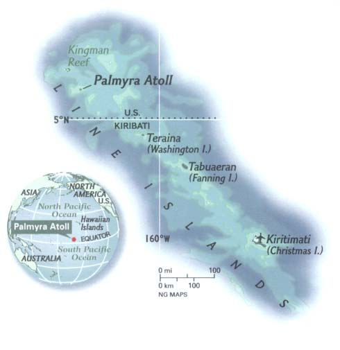
The Line Islands are small atolls located in the central tropical Pacific ocean. They include Christmas Island (2N, 157W), Fanning Island (4N, 160W), and Palmyra Island (6N, 162W). Their location makes them very sensitive to the El Nino - Southern Oscillation, which brings unusually warm and rainy conditions to the islands during El Nino events. Corals that grow on Line Island reefs record such climate variability in the geochemistry of their skeletons, providing records of El Nino and tropical Pacific climate change as far back as 6000 years before present.
For photos and more information, please see our Fanning Island, Palmyra Island, and Christmas Island entries below. See my research interests for more information about the scientific results to date.
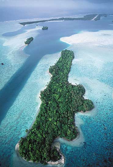
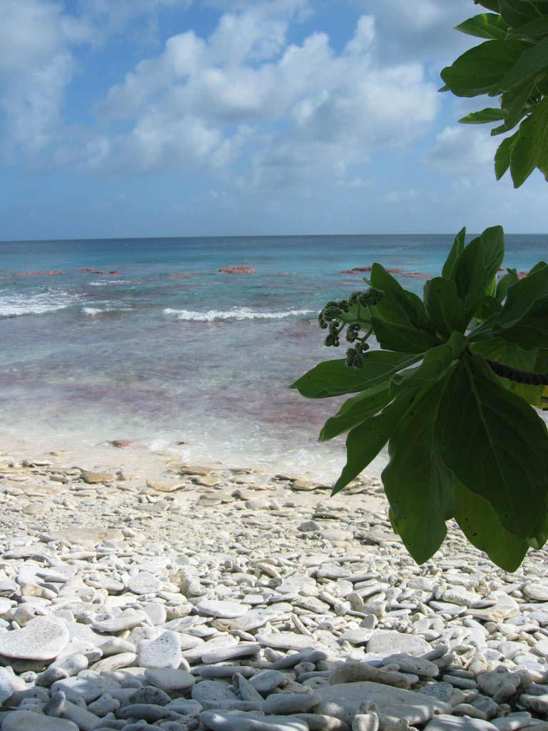
Aerial view of Palmyra (6N, 162W) Rubble beach at Fanning (4N, 160W)
SOUTHERN LINE ISLANDS EXPEDITION - Nov 2008
CHRISTMAS ISLAND - August 2005
Brought to you by...The remoteness of the Line Islands makes our fieldwork extremely difficult, and I am very grateful to the following organizations for their logistical and financial support of our field missions:
Khaled bin Sultan Living Oceans Foundation (May 1998 cruise to Christmas and Palmyra)
The Nature Conservancy (June 2000 field expedition to Palmyra)
Norwegian Cruise Line (May 2005 cruise to Fanning)
National Geographic WAITT Program (Nov 2008 cruise to Southern Line Isalnds)
The research is funded by grants from NOAA's Office of Global Programs, NSF's Earth System History, and the American Chemical Society.
This research is conducted in collaboration with Chris Charles of Scripps Inst. of Oceanography.
FANNING ISLAND - May 2005
I am constantly on the prowl for transport opportunities to the Line Islands, so I was delighted to hear that the Norwegian Cruise Line sends the cruise ship Norwegian Wind down to Fanning every 10 days for a 1-day visit to the island. After numerous phone calls and letters to NCL management, NCL agreed to take me, my field team, and over 1000 pounds of research equipment down to Fanning and retrieve us on the next cruise, 2 weeks later. Below you will find some pictures from the field trip, which focused on drilling fossil corals on land, collecting sea and rainwater for geochemical analysis, installing temperature loggers on the reef, and scouting the reef for healthy, large corals for future study.
Aerial view of Fanning Island (Tabuaeran, or "Sacred Footprint")
Fanning is roughly 15km long N-S and 10km E-W, and is dominated by the large lagoon. Located under the Inter-tropical Convergent Zone, it receives 1-2m of rainfall per year, which sustains lush plant life.
The island is inhabited by ~3000 Kiribati natives who were very welcoming and patient with the "crazy foreigners" (as we referred to ourselves) who came from America to drill rocks in their yards.
We stayed at the NCL compound, located just south of the main channel which connects the lagoon to the open ocean, on the western side of the island. Many thanks to the Fanning NCL staff (Robert Bryden and Roland Klein in particular) for making the trip not only scientifically successful, but fun.
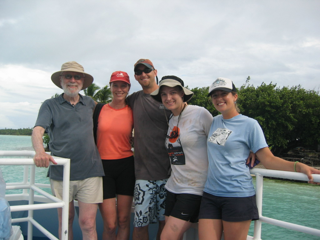
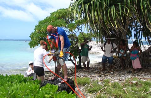
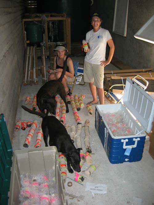
The field team (from left to right): Carlos Sluzki, Kim Cobb, Jordan Watson, Joanna Green, and Jessica Carilli
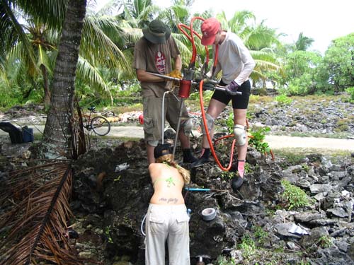
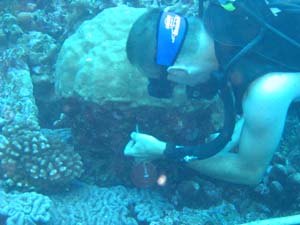
Drilling at the lagoon site with curious onlookers
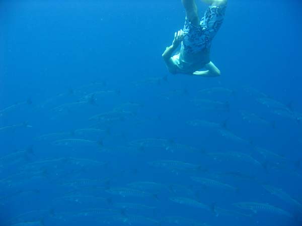
Jordan swimming with barracuda
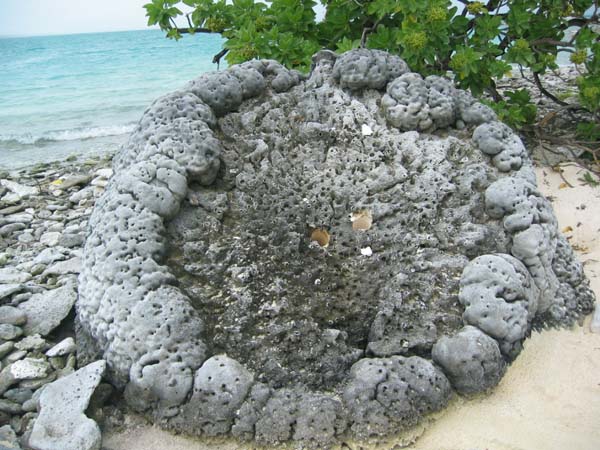
A large fossil Porites coral with 3"-diameter drill holes in center
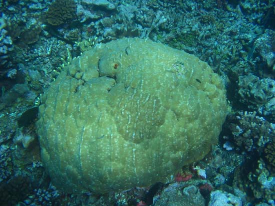
A large modern Porites coral growing on the reef
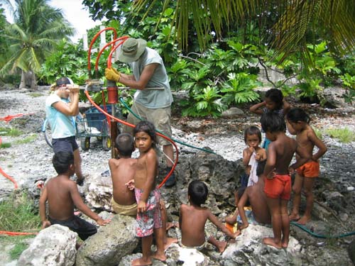
Drilling at the village site with ever-present entourage of children
Drilling large fossil coral in village
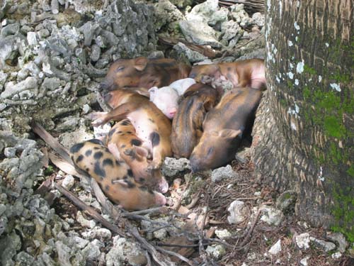
Piglets sleeping during drilling operations
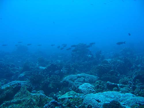
The very healthy southwest reef during our sole SCUBA dive
Jordan installing temperature loggers at base of Porites coral
Jessica and Joanna completing the inventory of over 25m of fossil corals, with help from the NCL's friendliest staffers
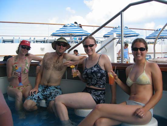
The field team hard at work aboard the Norwegian Wind (OK, so I couldn't resist)
The Norwegian Star arriving for a day at Fanning (Napali beach in foreground).
PALMYRA ISLAND - May 1998, June 2000, and August 2005
Palmyra is still my favorite place on Earth, although Fanning ranks a close second. I have been fortunate enough to visit Palmyra four times in the course of my research, three times by boat and once by air. I have slept on a mega-yacht docked in the lagoon, and camped on the remote north shore, under an occasional hail of coconuts.
Uninhabited but for a brief period during World War II, the island is as close to pristine as it gets. Today the main threats to the health of Palmyra's coral reefs are overfishing (particularly shark finning, which disturbs the delicate balances that characterize a healthy reef ecosystem) and continued warming of the ocean's waters (which prolongs the reef's recovery from natural stresses like El Nino events). Thankfully, the island was purchased by The Nature Conservancy in 2000, and has since been turned into a US Fish and Wildlife refuge for interdisciplinary scientific research. The Palmyra Research Consortium consists of Scripps Inst. of Oceanography, Stanford University, UCSB, UCI, and Univ. of Hawaii, which, together with the Moore Foundation, is helping to design Palmyra's future as a research station. The main mission of the Palmyra Research Consortium is to study the structure and evolution of the relatively healthy reef ecosystem at Palmyra towards developing better coral reef conservation and rehabilitation practices.
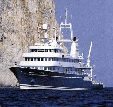
The M.Y. Golden Shadow, of the Khaled bin Sultan Living Ocean Foundation (and my transportation for the 1998 cruise to Palmyra).

One of the endangered coconut crabs living on Palmyra (National Geo, March 2002)
A baby boobie on Palmyra (National Geo, March 2002)
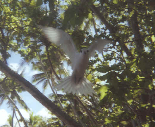
A fairy tern. Kim Cobb
Some of the millions of birds that call the island home.
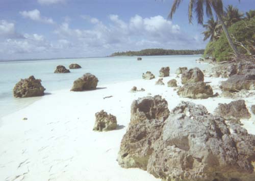
A white sand beach invites an afternoon nap (or fossil coral drilling, if you're me.) Kim Cobb